Photo rewind: Full BeltLine trail to close soon. Here's how it started
Josh Green
Thu, 05/16/2024 - 16:39
Atlanta BeltLine leaders are sending one reminder after the next: This weekend marks your last chance to enjoy the interim, unpaved western sections of the Southside Trail, y’all.
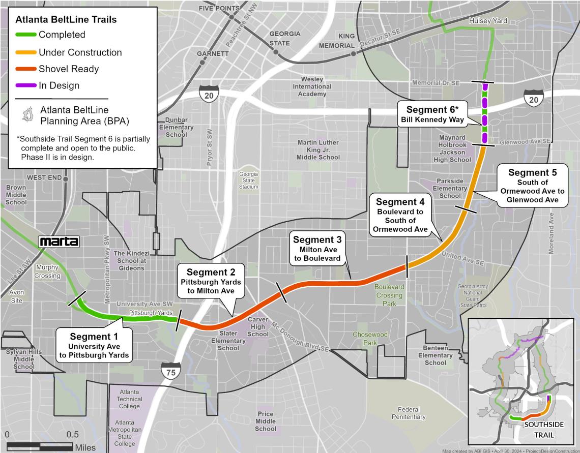
The Southside Trail’s Segments 2 and 3—stretching for 1.9 miles from Boulevard around to the Pittsburgh Yards district—are set to officially close to the public Monday. The corridor won’t open again until it’s paved and lighted. BeltLine leaders are targeting early 2026 to make that happen.
Which makes this a perfect time to remember how the full Southside Trail corridor started, just after the city had purchased its 4.5 miles and 63 acres for $26 million from longtime owner CSX.
 The status of construction and completion for the BeltLine's U-shaped, southernmost sections. Atlanta BeltLine Inc.
Below are snapshots— commissioned on a cloudy day in April 2018—from a much rawer, blighted urban landscape. It was prior to the corridor being cleared of old rails and debris, its bridges being stabilized, and other efforts to make it generally fit for ATLien habitation. The trail wouldn’t officially open in an interim state for another year and ½.
According to BeltLine officials, long days of Segment 2 and 3 trail work are expected to begin at 7 a.m. and conclude at 5 p.m. Monday through Friday, with weekends not off the table as make-up days for weather delays. Once it’s finished, nearly 18 miles of continuous BeltLine overall will be in place.
But before all of that, let’s have a quick trip down memory lane and recall how things began…
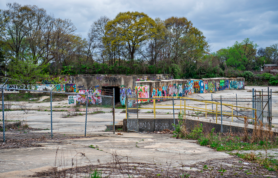
 In 2018, graffiti-covered walls behind Maynard Jackson High School marked the beginning of the Southside Trail’s nearly 4.5 mile crescent from Glenwood Avenue around to University Avenue. The 194-unit Argos Apartments have since been built here. Courtesy of Jonathan Phillips Photography
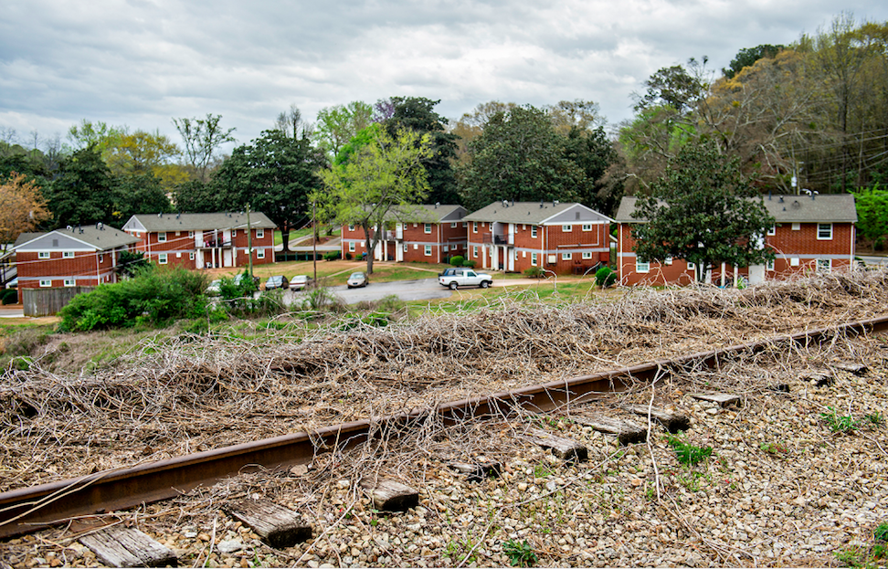
 A large modern residential compound has replaced the shuttered house seen below on Vera Street. Decommissioned railroad tracks have also long since been removed. Courtesy of Jonathan Phillips Photography
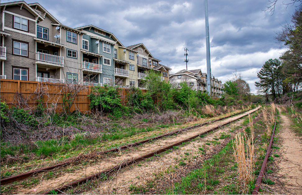
 View of the Trestletree Village Apartments from an elevated, overgrown section of the trail. Separate bridge infrastructure has recently been installed here (at bottom) where the Southside Trail will be routed. Courtesy of Jonathan Phillips Photography
 Another view of Trestletree Village and the old tracks. This section, from Glenwood Park to Boulevard, is fully under construction and scheduled to reopen next spring. Courtesy of Jonathan Phillips Photography
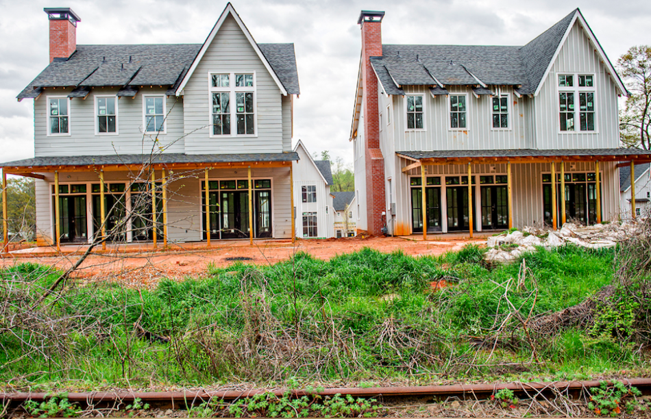 The 24-home Farmhouses at Ormewood Park project was just beginning to take shape in 2018. These dwellings would later become some of the neighborhood's first with $1-million pricing and up. Courtesy of Jonathan Phillips Photography
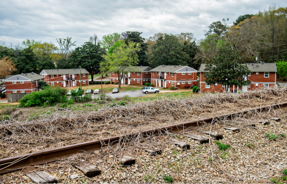
 Backside of Oldfield at Grant Park townhomes overlooking tracks six years ago. Courtesy of Jonathan Phillips Photography
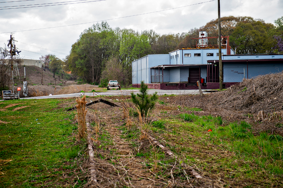
 The Cold Storage building at the BeltLine-Boulevard crossing has been replaced with the 323-apartment Boulevard at Grant Park project, where a Mellow Mushroom is being installing, taking about half of the project's 3,400 square feet of retail space.
Courtesy of Jonathan Phillips Photography
The Cold Storage building at the BeltLine-Boulevard crossing has been replaced with the 323-apartment Boulevard at Grant Park project, where a Mellow Mushroom is being installing, taking about half of the project's 3,400 square feet of retail space.
Courtesy of Jonathan Phillips Photography
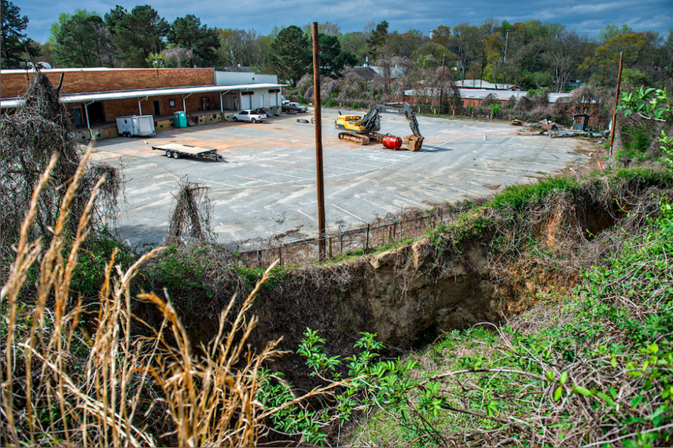 Pictured at bottom, a large sinkhole was a major source of BeltLine concern for urban wanderers in 2018. It's since been remediated. Courtesy of Jonathan Phillips Photography
 An old warehouse set back from Milton Avenue has been replaced by the sprawling Maverick apartment and townhome community.
Courtesy of Jonathan Phillips Photography
An old warehouse set back from Milton Avenue has been replaced by the sprawling Maverick apartment and townhome community.
Courtesy of Jonathan Phillips Photography
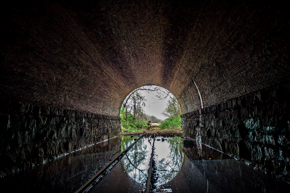
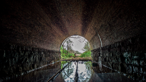
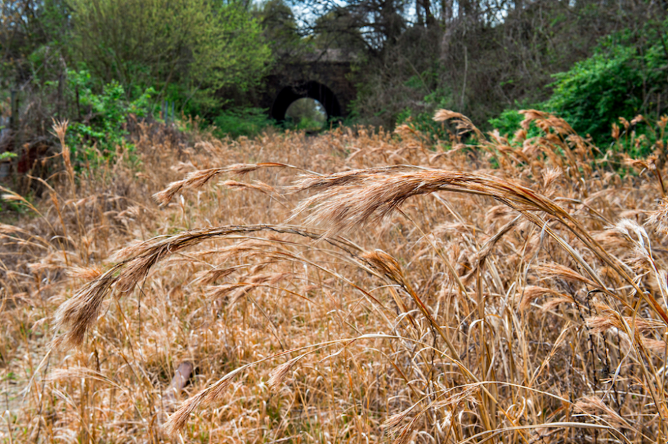 Approaching the McDonough Boulevard train tunnel—sure to become one of the most iconic features of the entire BeltLine loop soon. Courtesy of Jonathan Phillips Photography
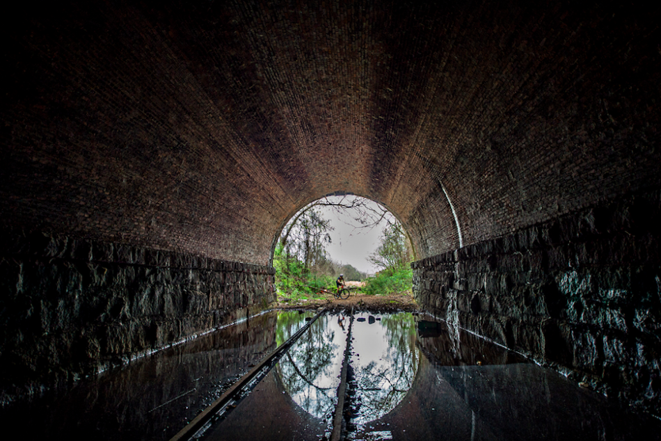 Inside the bridge (with active traffic lanes and rail overhead) before tracks were removed and lighting and flood mitigation measures were put in place. (Dude on mountain bike was having second thoughts.)Courtesy of Jonathan Phillips Photography
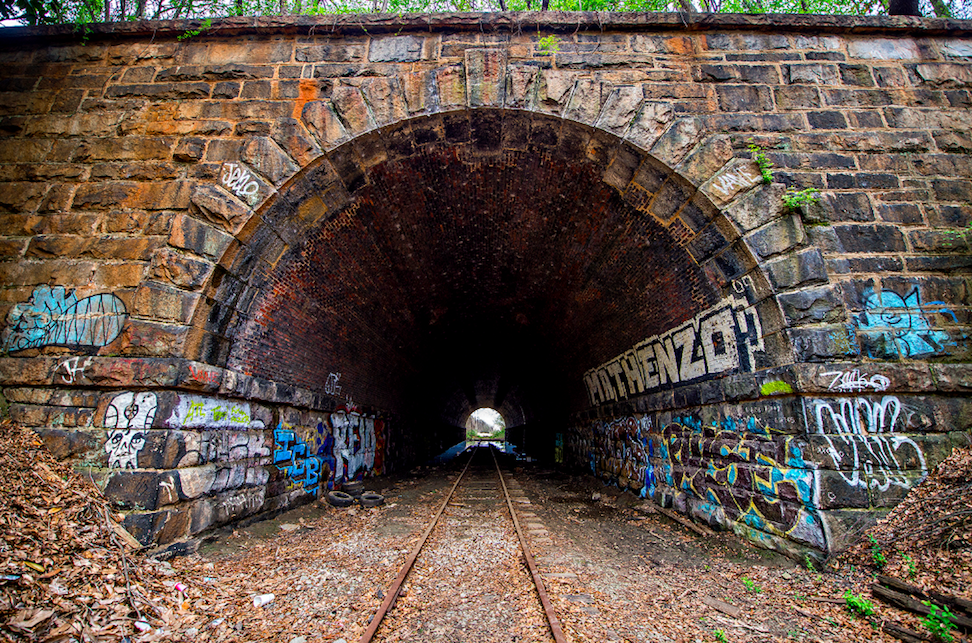
 Western side of the historic brick tunnel. Courtesy of Jonathan Phillips Photography
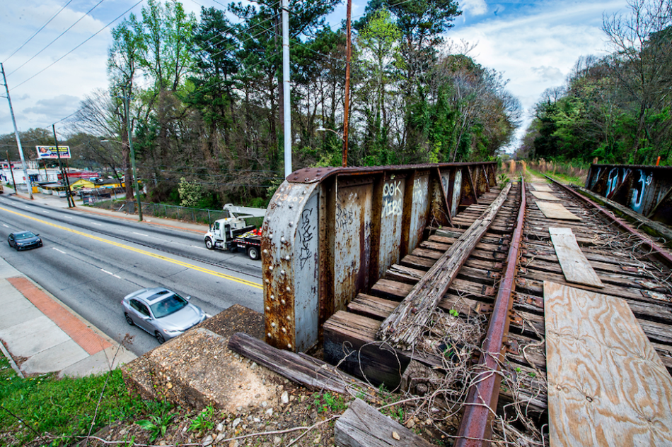
 The previous state of an ailing bridge crossing at Pryor Street.
Courtesy of Jonathan Phillips Photography
The previous state of an ailing bridge crossing at Pryor Street.
Courtesy of Jonathan Phillips Photography
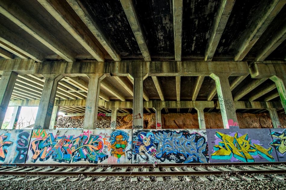 Graffiti and railroad infrastructure beneath the Interstate 85 overpass, due south of downtown.Courtesy of Jonathan Phillips Photography
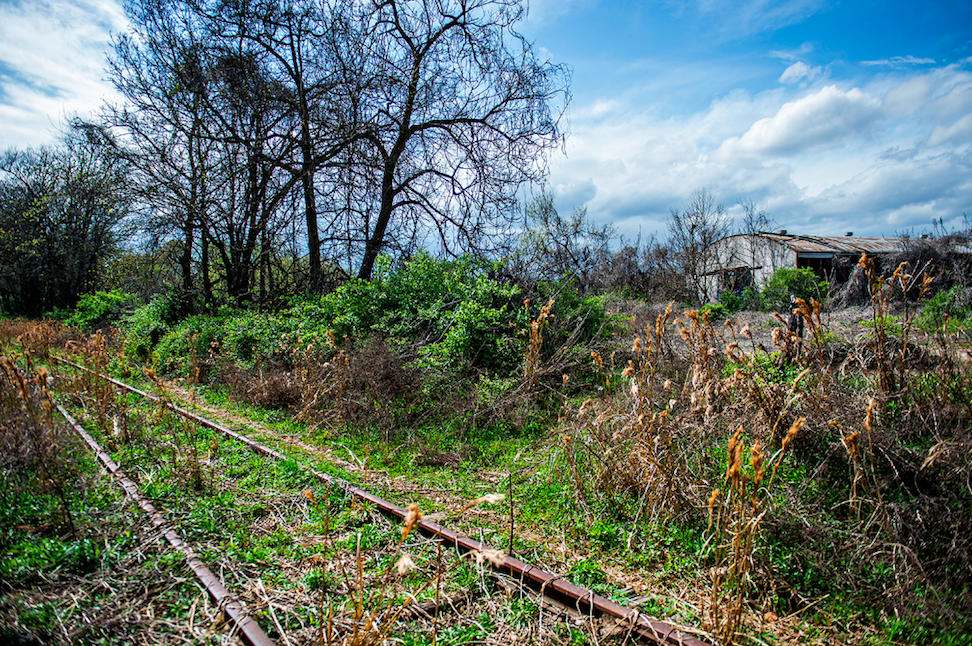
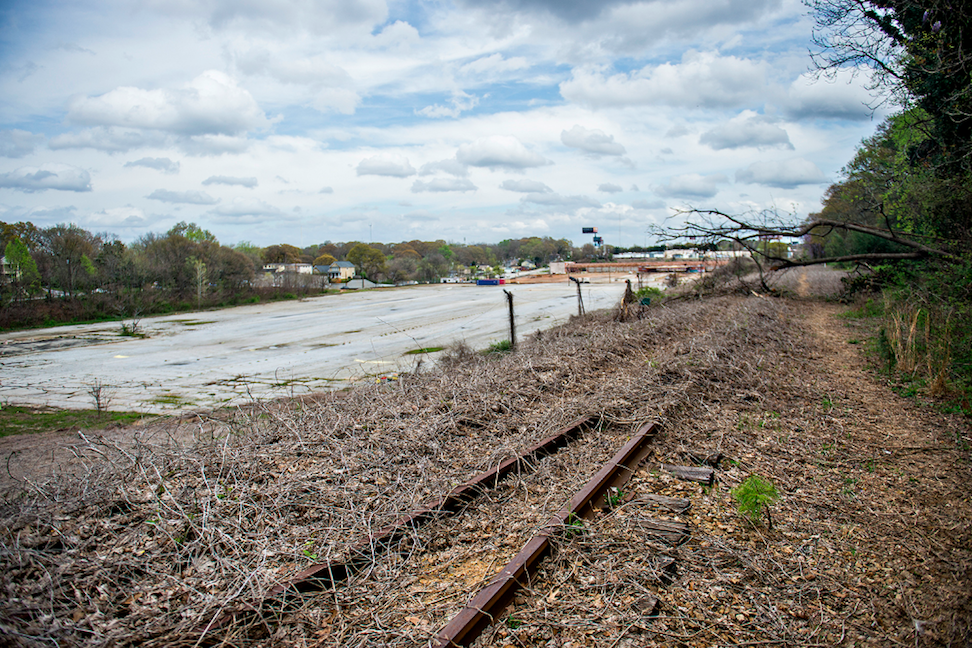
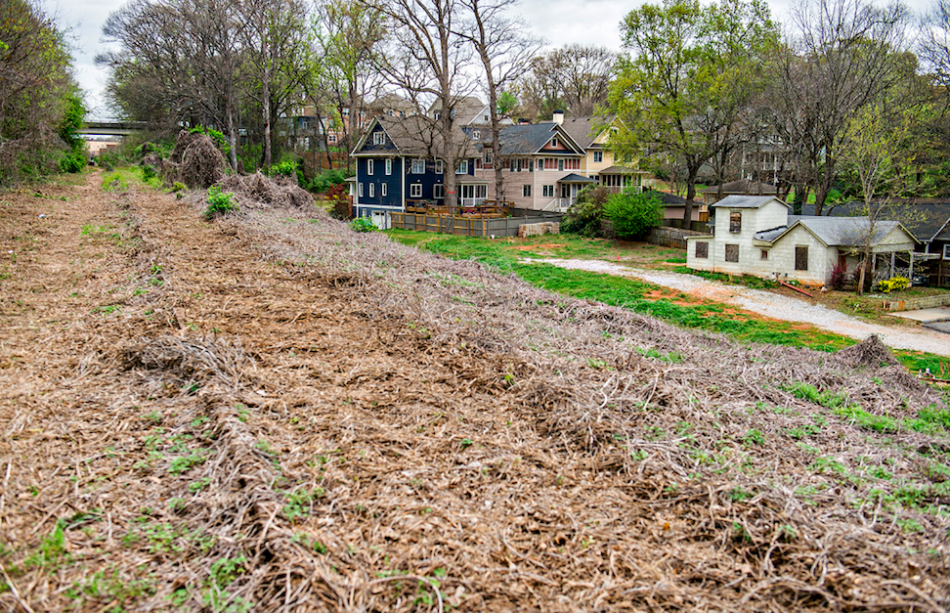
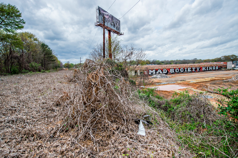 The overgrown Southside Trail corridor and what would become the 31-acre Pittsburgh Yards jobs hub. Courtesy of Jonathan Phillips Photography
 View of vast property now owned by the BeltLine and Pittsburgh Yards in the distance. Courtesy of Jonathan Phillips Photography
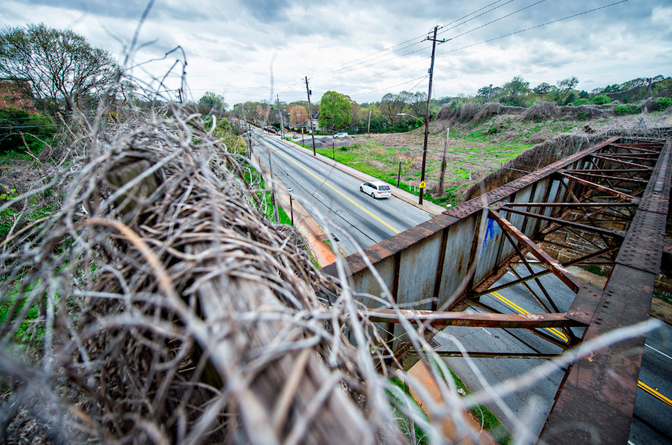
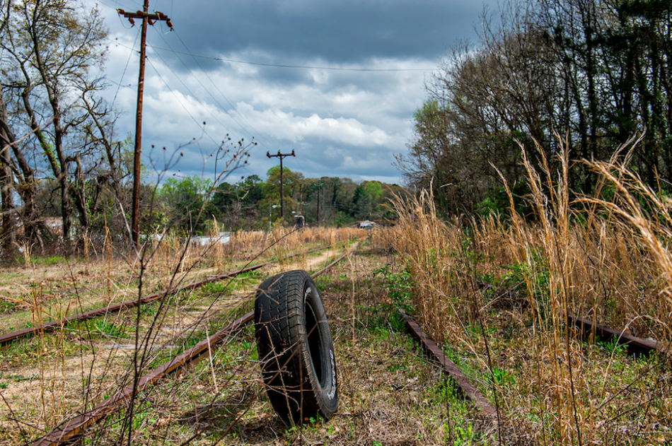
 Crossing over Metropolitan Parkway—with a bridge reminiscent of the Eastside Trail structure, prior to refurbishment, that passes over Ponce de Leon Avenue.Courtesy of Jonathan Phillips Photography
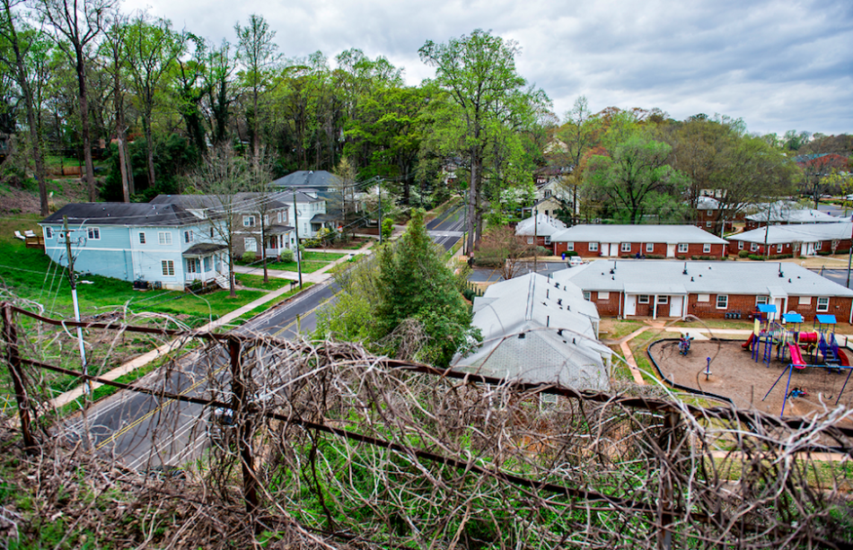
 Lastly, how the Southside-Westside trail's junction near University Avenue appeared six years ago. Try to imagine all the above six years from now. Courtesy of Jonathan Phillips Photography
...
Follow us on social media:
Twitter / Facebook/and now: Instagram
• Chosewood Park news, discussion (Urbanize Atlanta)
Tags
Grant Park
Peoplestown
Capitol View
Connector
Southside Trail
Beltline
The Beacon
Atlanta BeltLine
BeltLine Construction
Jonathan Phillips
Photo Essays
Visual Journeys
Urbanize Photos
Images
In 2018, graffiti-covered walls behind Maynard Jackson High School marked the beginning of the Southside Trail’s nearly 4.5 mile crescent from Glenwood Avenue around to University Avenue. The 194-unit Argos Apartments have since been built here. Courtesy of Jonathan Phillips Photography
A large modern residential compound has replaced the shuttered house seen below on Vera Street. Decommissioned railroad tracks have also long since been removed. Courtesy of Jonathan Phillips Photography
View of the Trestletree Village Apartments from an elevated, overgrown section of the trail. Separate bridge infrastructure has recently been installed here (at bottom) where the Southside Trail will be routed. Courtesy of Jonathan Phillips Photography
Another view of Trestletree Village and the old tracks. This section, from Glenwood Park to Boulevard, is fully under construction and scheduled to reopen next spring. Courtesy of Jonathan Phillips Photography
The 24-home Farmhouses at Ormewood Park project was just beginning to take shape in 2018. These dwellings would later become some of the neighborhood's first with $1-million pricing and up. Courtesy of Jonathan Phillips Photography
Backside of Oldfield at Grant Park townhomes overlooking tracks six years ago. Courtesy of Jonathan Phillips Photography
The Cold Storage building at the BeltLine-Boulevard crossing has been replaced with the 323-apartment Boulevard at Grant Park project, where a Mellow Mushroom is being installing, taking about half of the project's 3,400 square feet of retail space.
Courtesy of Jonathan Phillips Photography
Pictured at bottom, a large sinkhole was a major source of BeltLine concern for urban wanderers in 2018. It's since been remediated. Courtesy of Jonathan Phillips Photography
An old warehouse set back from Milton Avenue has been replaced by the sprawling Maverick apartment and townhome community.
Courtesy of Jonathan Phillips Photography
Approaching the McDonough Boulevard train tunnel—sure to become one of the most iconic features of the entire BeltLine loop soon. Courtesy of Jonathan Phillips Photography
Inside the bridge (with active traffic lanes and rail overhead) before tracks were removed and lighting and flood mitigation measures were put in place. (Dude on mountain bike was having second thoughts.)Courtesy of Jonathan Phillips Photography
Western side of the historic brick tunnel. Courtesy of Jonathan Phillips Photography
The previous state of an ailing bridge crossing at Pryor Street.
Courtesy of Jonathan Phillips Photography
Graffiti and railroad infrastructure beneath the Interstate 85 overpass, due south of downtown.Courtesy of Jonathan Phillips Photography
The overgrown Southside Trail corridor and what would become the 31-acre Pittsburgh Yards jobs hub. Courtesy of Jonathan Phillips Photography
View of vast property now owned by the BeltLine and Pittsburgh Yards in the distance. Courtesy of Jonathan Phillips Photography
Crossing over Metropolitan Parkway—with a bridge reminiscent of the Eastside Trail structure, prior to refurbishment, that passes over Ponce de Leon Avenue.Courtesy of Jonathan Phillips Photography
Lastly, how the Southside-Westside trail's junction near University Avenue appeared six years ago. Try to imagine all the above six years from now. Courtesy of Jonathan Phillips Photography
Subtitle
A look back at Southside Trail corridor's raw beginnings on eve of construction closure
Neighborhood
Chosewood Park
Background Image
Image
Before/After Images
Sponsored Post
Off
Photographer
Jonathan Phillips
Photographer Link
https://jonathanphillipsphotography.com/portraits/
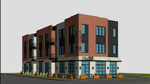
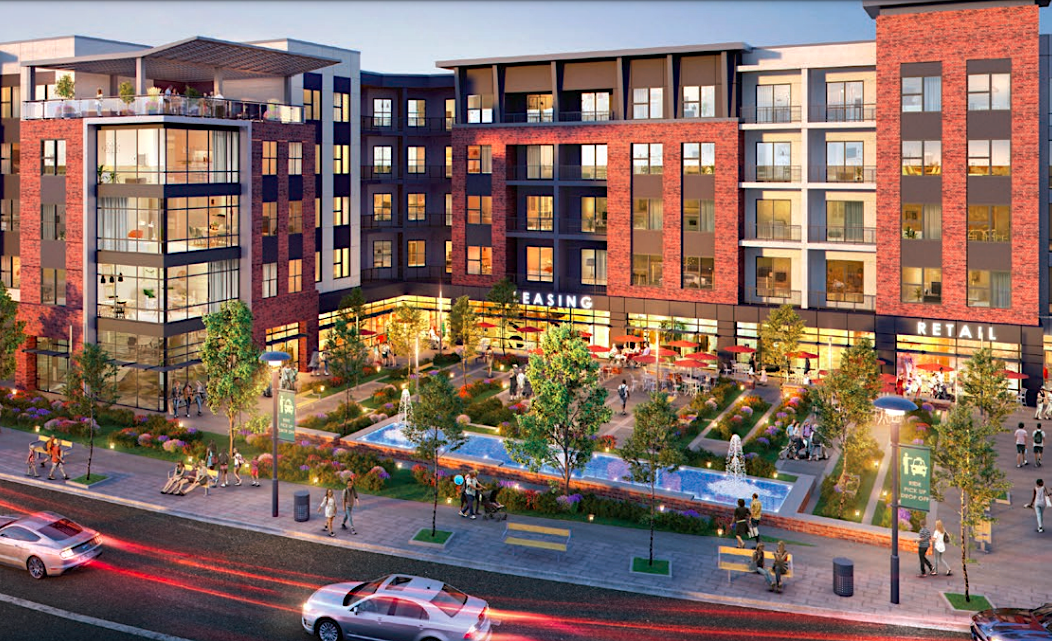
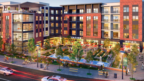
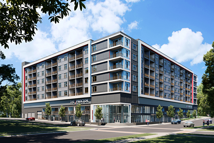
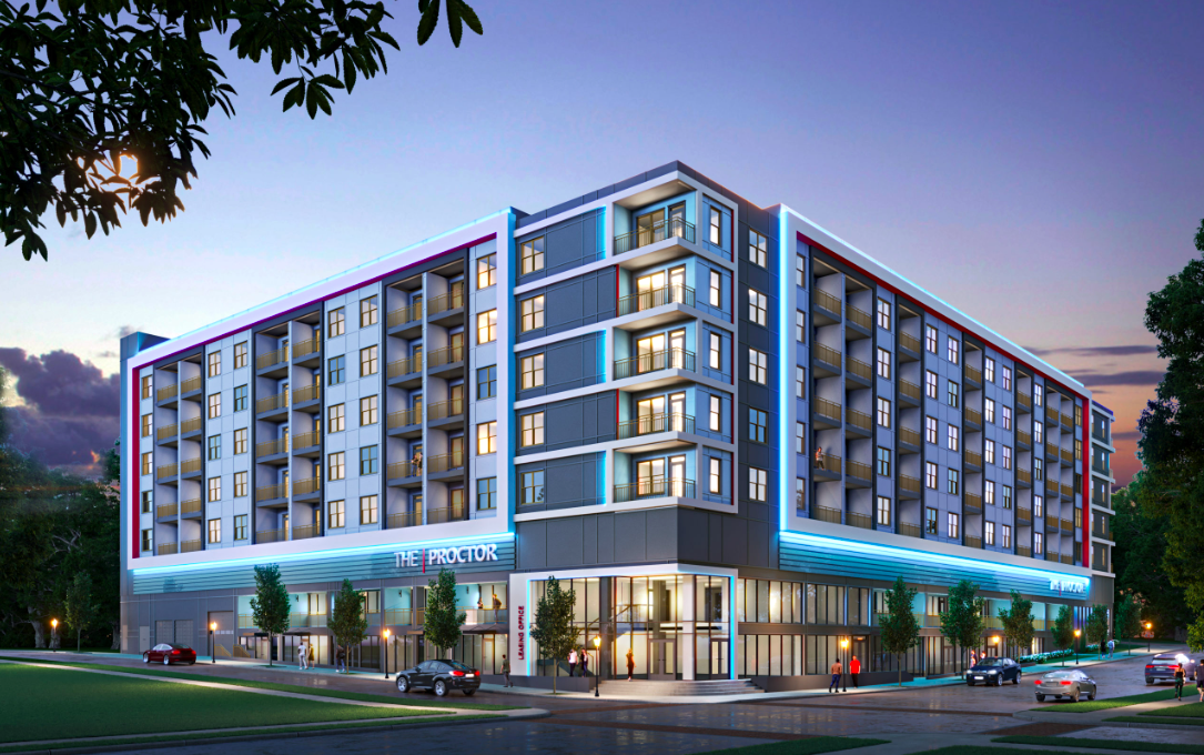
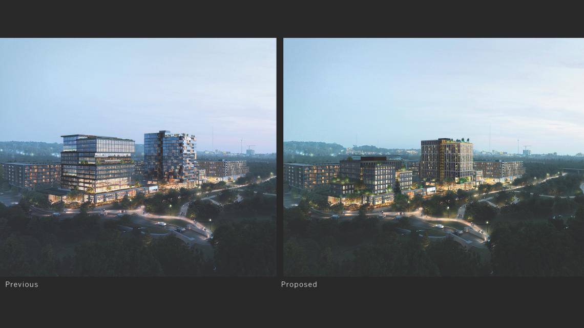
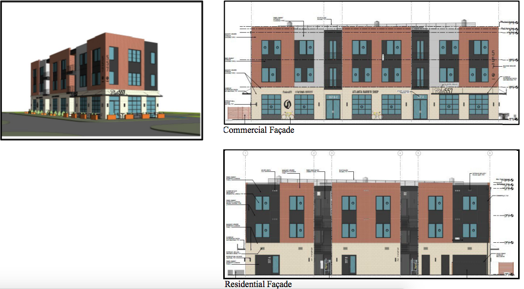 OaksATL Community Development; via Invest Atlanta
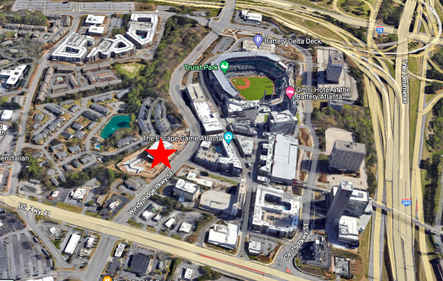
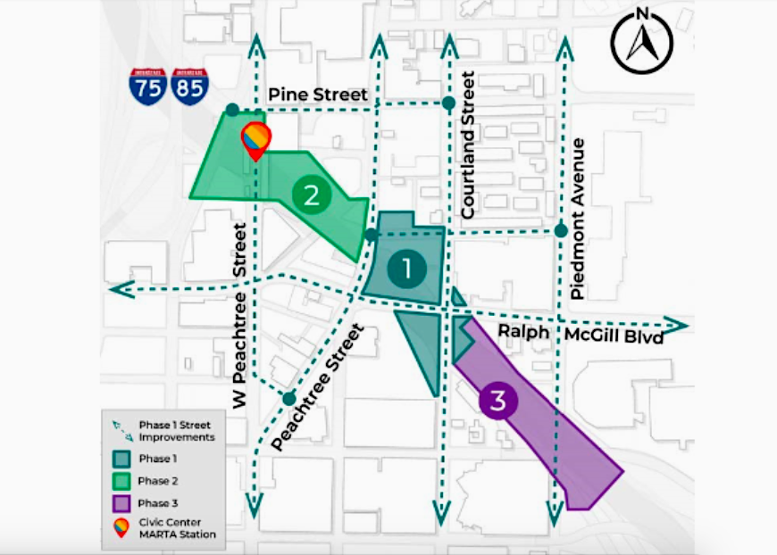
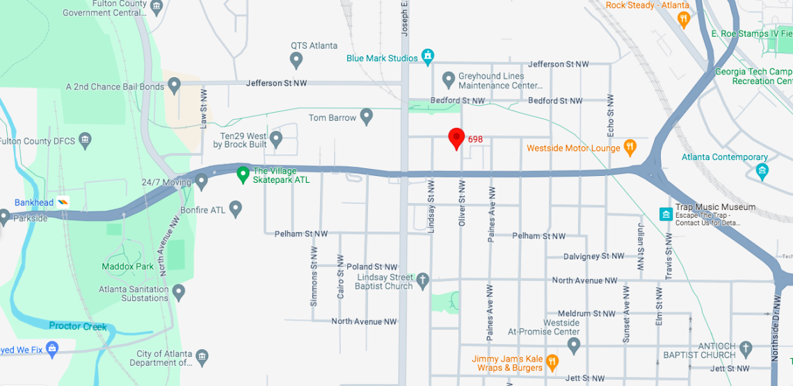
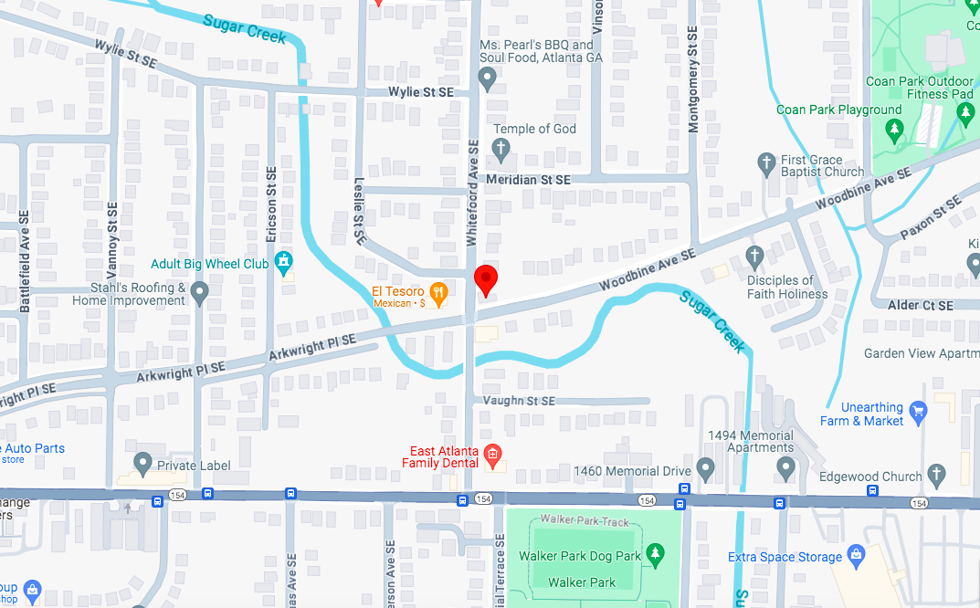
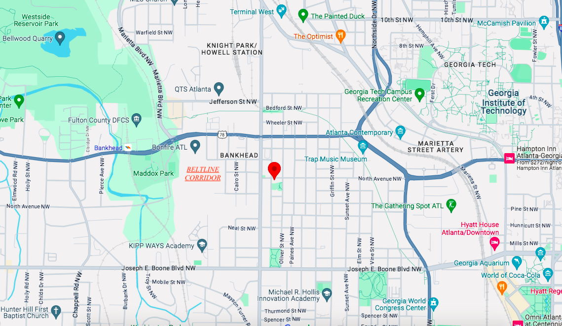 Location of the English Avenue corner site in relation to the Westside Trail corridor, Midtown, and Westside Park. Google Maps
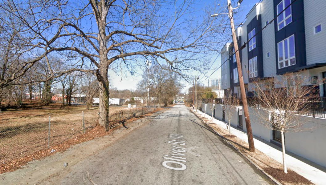
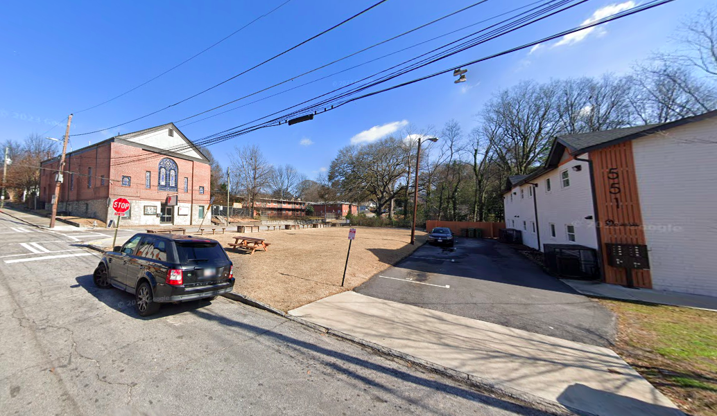 The corner site where Lindsay Street meets North Avenue today. Google Maps
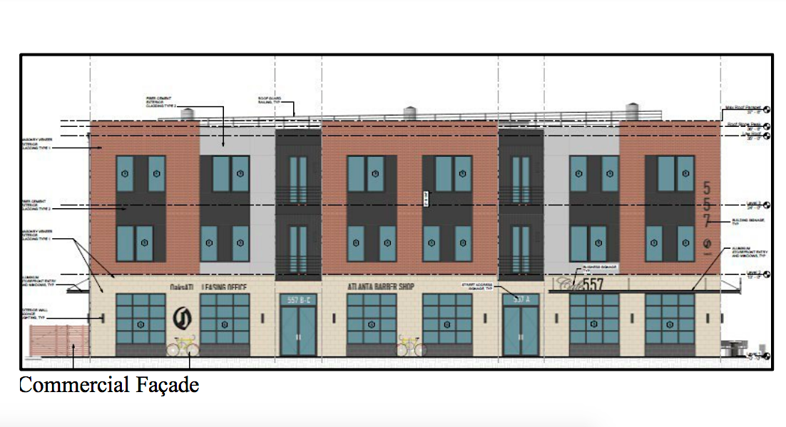 OaksATL Community Development; via Invest Atlanta
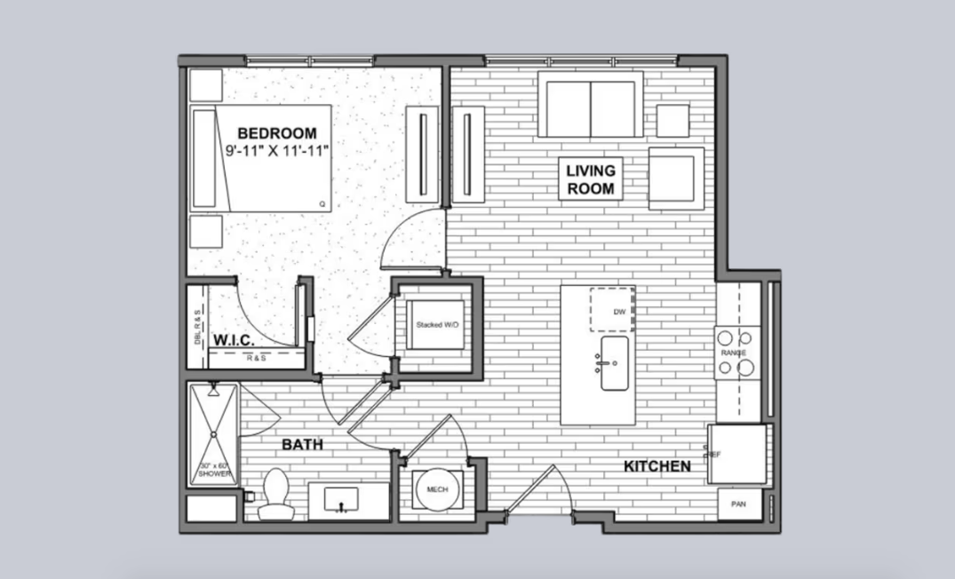
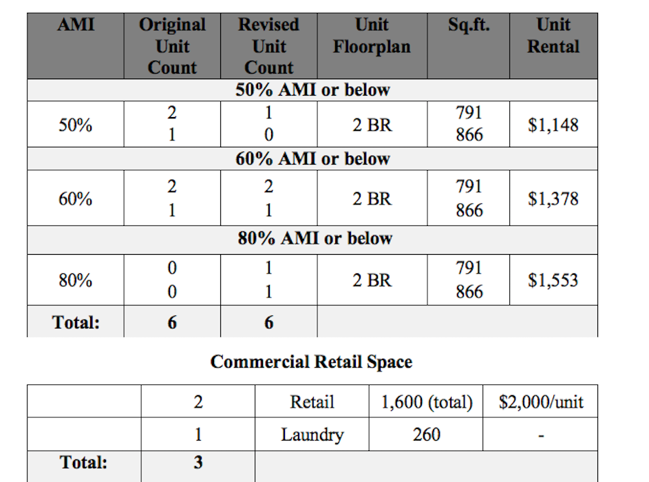 Planned breakdown for 557 Lindsay St. unit rents, both residential and commercial. Invest Atlanta
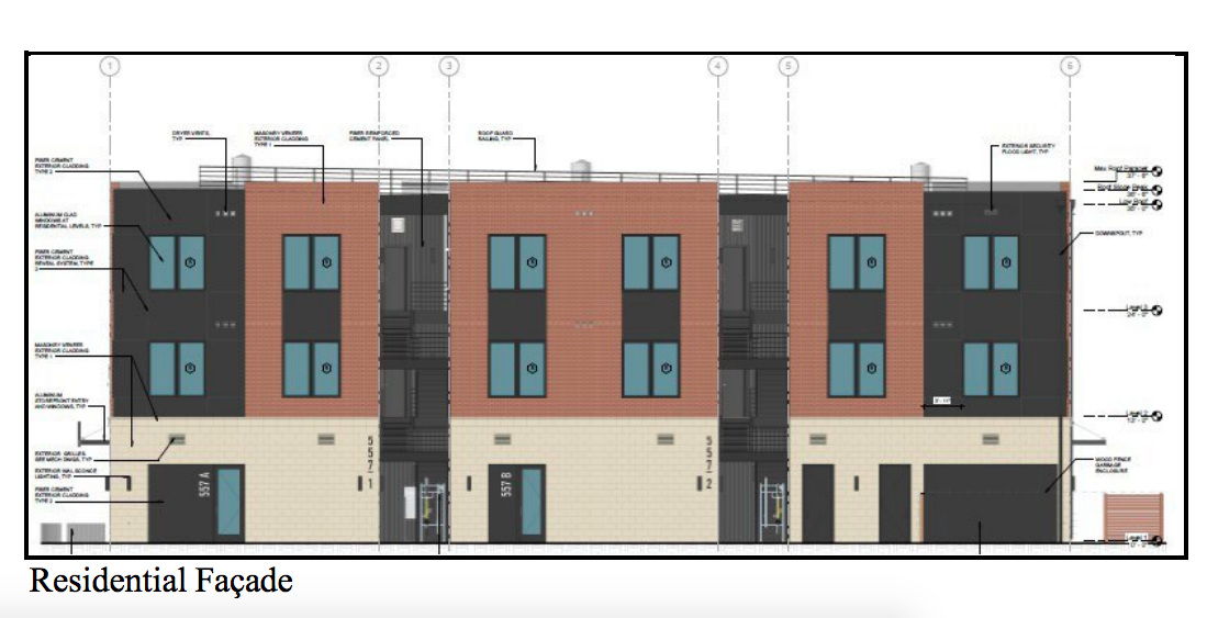 OaksATL Community Development; via Invest Atlanta
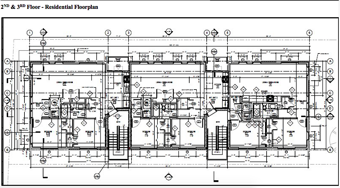 OaksATL Community Development; via Invest Atlanta
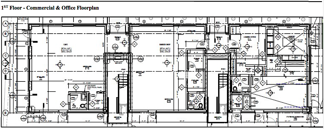 OaksATL Community Development; via Invest Atlanta
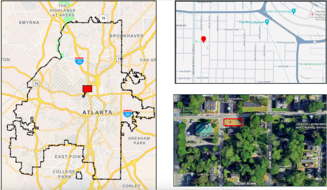 OaksATL Community Development; via Invest Atlanta