CoMaps

299 readers
13 users here now

Cooperative community open-source fork of Organic Maps, an offline privacy-respecting not-for-profit OpenStreetMap GPS app for your phone.

https://www.comaps.app/

Codeberg

Matrix

Mastodon


founded 1 month ago
MODERATORS
1


The day I was supposed to join a group of young women to map Gros Islet, an old fishing village on the Caribbean Island of St. Lucia, I got lost. Proann Francis, who was helping lead the expedition, had told me to meet everyone at Care Growell School, which Google Maps informed me was some 8,500 miles away, in Uttar Pradesh, India. “Where?” I asked. She instructed me to wait outside my hotel for a ride because it would be impossible to find the place on my own. An hour later, I found myself standing at the side of a dusty St. Lucian highway as a vintage red Toyota van pulled up. I squeezed in, between Francis and the driver. Behind us, a group of young women sat wearing matching light blue shirts that read “Women Mappers.”

“We have some heavy mapping to do today!” Francis announced, breaking into a toothy smile, her dark hair pulled back neatly into a bun.

Most of St. Lucia, which sits at the southern end of an archipelago stretching from Trinidad and Tobago to the Bahamas, is poorly mapped. Aside from strips of sandy white beaches that hug the coastline, the island is draped with dense rainforest. A few green signs hang limp and faded from utility poles like an afterthought, identifying streets named during more than a century of dueling British and French colonial rule. One major road, Micoud Highway, runs like a vein from north to south, carting tourists from the airport to beachfront resorts. Little of this is accurately represented on Google Maps. Almost nobody uses, or has, a conventional address. Locals orient one another with landmarks: the red house on the hill, the cottage next to the church, the park across from Care Growell School.

Our van wound off Micoud Highway into an empty lot beneath the shade of a banana tree. A dog panted, belly up, under the hot November sun. The group had been recruited by the Humanitarian OpenStreetMap Team, or HOT, a nonprofit that uses an open-source data platform called OpenStreetMap to create a map of the world that resembles Google’s with one key exception: Anyone can edit it, making it a sort of Wikipedia for cartographers.

The organization has an ambitious goal: Map the world’s unmapped places to help relief workers reach people when the next hurricane, fire, or other crisis strikes. Since its founding in 2010, some 340,000 volunteers around the world have been remotely editing OpenStreetMap to better represent the Caribbean, Southeast Asia, parts of Africa and other regions prone to natural disasters or humanitarian emergencies. In that time, they have mapped more than 2.1 million miles of roads and 156 million buildings. They use aerial imagery captured by drones, aircraft, or satellites to help trace unmarked roads, waterways, buildings, and critical infrastructure. Once this digital chart is more clearly defined, field-mapping expeditions like the one we were taking add the names of every road, house, church, or business represented by gray silhouettes on their paper maps. The effort fine-tunes the places that bigger players like Google Maps get wrong — or don’t get at all.

archived (Wayback Machine)

2


So I've found out about CoMaps and was intrigued because one of the main features it listed was the inclusion of hiking trails. But for the life of me I can't figure out how to enable them. Is this something that is just a planned feature at this point? Or am I missing something?

3


Shape the face of CoMaps! People in the community have added their designs, collaborated and iterated, and now it's up to you to decide which one will represent us best.

– Check Out the Designs: Take a look at the different logo options and see which one resonates with you the most - https://codeberg.org/comaps/Governance/issues/73 – Vote: Add 👍 reaction to your favorite designs.

Criteria · Simple: easy to draw from memory · Unique · Subtly reflects idea of travel, maps, community, or outdoors

Deadline 9 June: Voting closes Monday. Make your voice heard!

Which logo do you like best?

4


CoMaps has just been added to Product Hunt! We're hoping to make it to the top of the page. Right now, we have 4 upvotes, and the top product has 358 upvotes. Let's see if we can get CoMaps to the top!

Help Us Reach the Top!

  1. Upvote CoMaps: https://www.producthunt.com/products/comaps-2
  2. Add Comment: What is your favorite way to use offline maps?

Why CoMaps? · Offline Maps: Hike, bike, and drive without an internet connection. · Privacy-Focus: Navigate with ease and no tracking. · Community-Powered: Built by this amazing community.

Every upvote helps more people discover CoMaps. Thank you! 🌍❤️

5


A initial preview for CoMaps is now available for android, in .APK form, from the CoMaps codeberg page

6
5
submitted 1 week ago* (last edited 1 week ago) by oleg_rswll@sopuli.xyz to c/CoMaps@sopuli.xyz


Attention All Creative Minds!

CoMaps is on a mission to work together as a community, and we need your creativity to help to do it! We’re inviting all designers, artists, and creative thinkers to collaborate and create a stunning new logo for CoMaps.

Joining?

  • Showcase Your Talent: This is your chance to shine and get your work seen by a global community.
  • Collaborate with Creatives: Connect with fellow designers, artists and creative people from around the world.

How to Participate:

  1. Design Your Logo: Create a unique and eye-catching logo that represents the spirit of CoMaps.
  2. Share Your Work: Add your design on Codeberg https://codeberg.org/comaps/Governance/issues/23
  3. Collaborate: Feel free to team up with other creatives to iterate and make your design even better!
  4. Tag Us: Post on your social media channels using the hashtag #CoMapsLogoChallenge. Tag CoMaps in your posts so we can see your amazing creations!

Deadlines:

6 June - Design and iteration completed

9 June - Round 1 voting completed

12 June - Iteration completed

15 June - Round 2 voting completed

Criteria:

  • Simple: easy to draw from memory
  • Unique
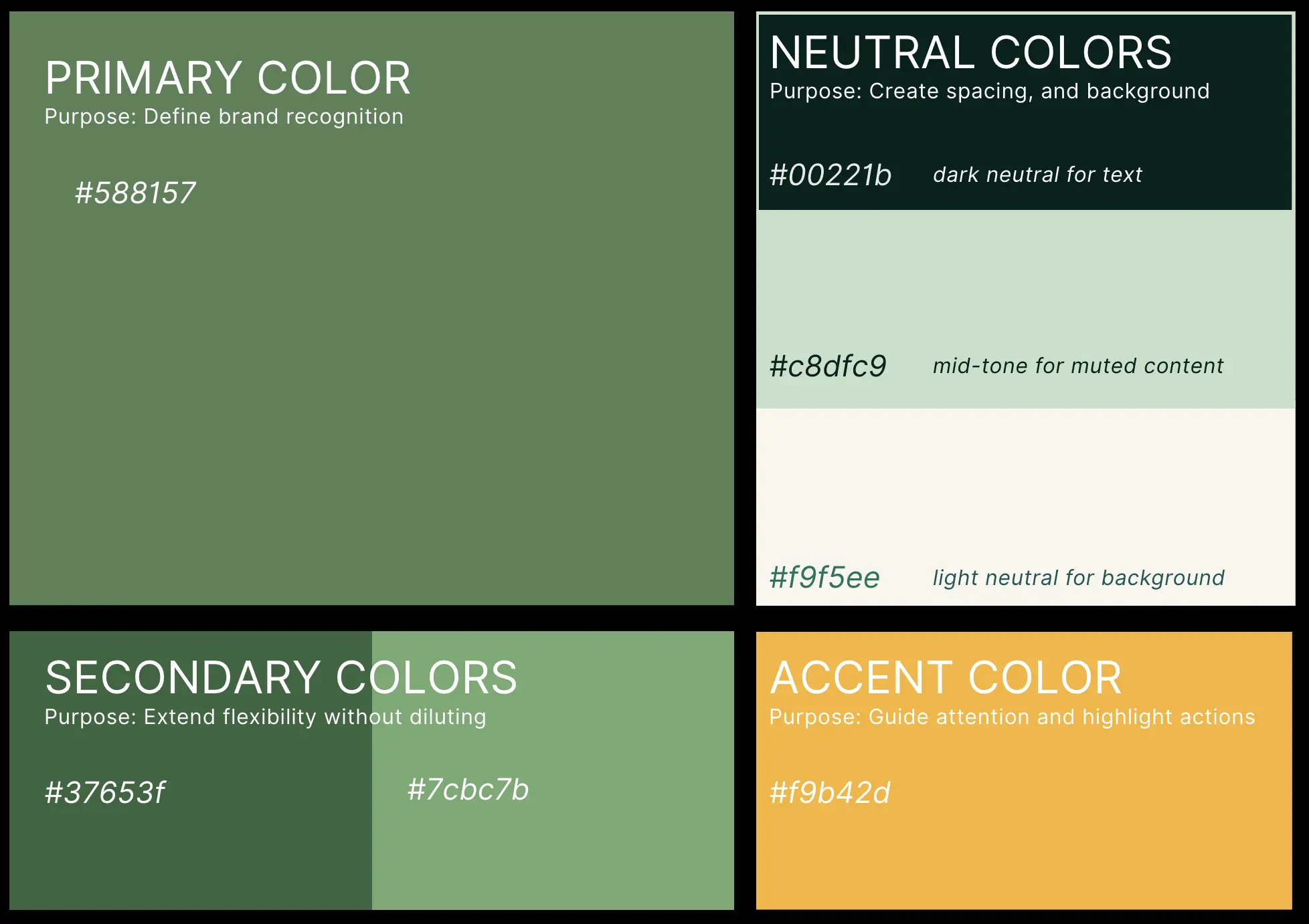
  • Monochrome in # 588157 brand color
  • Subtly reflects idea of travel, maps, community, or outdoors

We can't wait to see what you come up with! Let’s make CoMaps even more amazing together.

7


Hello all, I'm sorry in advance if this is something which is discussed in length in the past and/or opening up old wounds. I wasn't involved in the community of "OrganicMaps" but have been a user for quite some time now.

One thing i was always wondering about is if it is beneficial to have the app branded as an app for cyclists, drivers and hikers with an heavy emphasis on it being able to have maps offline. It honestly kinda put me off at first as somebody who just wants to have an privacy respecting alternative with focus on the collaborative side. I can see the benefit of it managing expectations as some parts like having to download maps could feel off or it not having the most up to date information like traffic jams. But i also believe that there are quite a lot of people who would excited about the concept of OSM. If it has a nice app for general use.

Just thought as i really liked the name change which came with the fork it might now be a great time to think about that. Was that a topic in the past?

8


We're delighted to reveal that after brainstorming, lots of creative input, and voting, you have chosen the color for CoMaps! 🎨

The winning color is – ‘deep olive green’! This was the top pick in the community collaboration. The color reflects our community's passion for travel and the outdoors, with a warm, calm, and happy appeal which reflects a friendly and visually appealing experience!

A big thank you to everyone who shared their thoughts and voted . Your input has truly made this app a reflection of the community.

9


We're excited to share that the community has spoken, and the name chosen for the community navigation app is... CoMaps! 🎉

The name is very popular, it received twice as many votes (92 votes) as the second choice option (44 votes), and third choice (37 votes).

Thank you to everyone who participated, your enthusiasm and community collaboration are incredible!

Recap

· Goal: The aim for a name was easy pronunciation that resonated with the project's essence, and was not already trademarked.

· Voting: Community members voted by adding 👍 to their favorite names and suggesting names (https://codeberg.org/comaps/Governance/issues/34).

CoMaps stood out for its simplicity and catchiness, as well as for its perfect alignment with the mission to create a community-driven navigation app that empowers people to explore and navigate the world.

What's Next?

The community will select the color scheme of the project. If you are interested in collaborating to develop the color scheme, check it out! https://codeberg.org/comaps/Governance/issues/56

10


We’re thrilled to announce that comaps.app is now live! Explore the latest updates about the app, features, and more on the brand-new website.

Check out comaps.app and discover how you can transform the way you navigate, explore, and share your favorite places. Whether you're a traveler, a local explorer, or just someone who loves maps, CoMaps helps you discover more of your journey!

Latest News: Stay up-to-date with the latest updates and development progress.

Community Features: Connect with people in the community on your favorite platform, and see what others are contributing.

What Makes CoMaps Different: See the ideas behind CoMaps Enjoy a sleek and intuitive design that makes it easy to find what you need.

What’s Next? Your feedback is invaluable, so please let us know what you think and what you’d like to see next. Join us on this journey and help us make comaps.app even better. Share your thoughts, experiences, and suggestions in the comments below!

11


Why does it feel like navigation apps are more interested in your data than in helping you find your way? That's why we are working to create CoMaps – a community-driven, open-source navigation app designed for you to take the lead.

· Open & Transparent: All decisions are made in public, with full transparency.

· Privacy-respecting: The app doesn’t track you or collect your data.

· Community Empowerment: You have a voice in how the app evolves.

· Free & Not-for-Profit: Our focus is on creating value for the community, not generating profit.

Join us in building a navigation app that truly serves the public good!

12
13
2
Name Ideas (sopuli.xyz)
submitted 1 month ago* (last edited 4 weeks ago) by CubeOfCheese@sopuli.xyz to c/CoMaps@sopuli.xyz


Edit: official voting now happening here: https://codeberg.org/comaps/Governance/issues/34

Please comment with your name ideas.

One name per comment.

Top level comments should just be the name. You can put reasons and discuss each idea in the comments below each suggestion.

And vote on what you like!

14


Maybe the Lemmy community can be Official this time!